.svg)

Precision Below Ground. Confidence Above.
Your subsurface answers.
Faster, better, and with zero footprint.
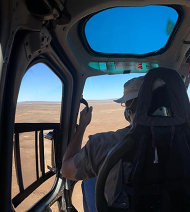
22+ years of innovation. Over 2 million helicopter flown line kilometers. SkyTEM reveals what lies beneath - protecting what matters while uncovering what's possible.

Water
Map and protect groundwater resources with unmatched precision. Our airborne electromagnetic surveys deliver the subsurface insight needed for sustainable water management and aquifer characterization — all without disrupting terrain.

Mineral Exploration
Accelerate discovery and reduce risk. SkyTEM’s calibrated data reveal conductors and geological structures with exceptional clarity, enabling efficient, responsible exploration in any terrain.

Geotechnical
Design with confidence. Our high-resolution airborne data provide complete subsurface characterization for foundation studies and environmental assessments — safely, accurately, and fast.


The SkyTEM technology was chosen because it is particularly well suited for large-scale groundwater mapping. The system can rapidly acquire consistent electromagnetic and magnetic data while flying at low altitude, producing high-resolution images of the subsurface from near the surface down to several hundred meters in depth. Compared to conventional ground-based surveys, SkyTEM can cover large regions quickly and non-invasively, providing a continuous picture of aquifer systems that would otherwise require years of investigation. Based on the quality of the data, the technical expertise of the personnel involved throughout the survey, and their ability to manage unforeseen events, SkyTEM is highly recommended for organizations seeking to obtain the best possible subsurface information and confidently define drilling targets for effective and efficient exploitation of groundwater resources.
.webp)

For over 15 years, SkyTEM has been our trusted partner in enabling the acquisition of high-quality, perfectly calibrated airborne electromagnetic data across France—from the mainland to our overseas departments and territories.
Throughout our long-standing collaboration, SkyTEM has consistently pushed the boundaries of innovation, continuously improving both depth of investigation and near-surface resolution. This cutting-edge data has proven invaluable for a diverse range of critical applications, including raw materials prospecting and landslide risk assessment. Crucially, their technology has revolutionized our hydrogeological knowledge. By mapping groundwater resources with incredible precision, SkyTEM provides the insights we need to support vital sustainability initiatives and secure water resilience in a changing climate.
.webp)

Throughout the Brokilde project, SkyTEM demonstrated strong operational performance, effectively managing the logistical challenges of the Danish landscape while delivering high quality geophysical mapping. The SkyTEM Diamond system provided high-resolution data from the nearest surface (as shallow as 1 meter) down to depths of 200 meters, offering the necessary data for an update of the geological model in the catchment area at Brokilde. Combined with the professional delivery of digital datasets and reporting, SkyTEM and Ramboll have provided data for further analysis that are needed for renovating Brokilde well field.
.webp)

We are pleased to acknowledge the exceptional contribution of SkyTEM Surveys ApS to our recent airborne electromagnetic (AEM) survey initiative in Maun, Botswana. Contracted by Kemcore Botswana (Proprietary) Limited, SkyTEM undertook an extensive survey comprising approximately 6,100 line kilometres, with a line spacing of 1,000 metres and detailed infill lines at 500 and 250 metres respectively.
SkyTEM’s operational efficiency and deep technical expertise were evident throughout the project, delivering highly accurate geophysical data that proved instrumental in mapping subsurface aquifers, including brine-rich formations. This work significantly supported our sustainable groundwater management efforts and informed strategic decisions in water sourcing and mineral extraction.SkyTEM’s professionalism and commitment to excellence make them a highly recommended partner for any geophysical exploration campaign.
.webp)

In February 2021, SkyTEM Surveys ApS carried out a helicopter-borne EM/MAG geophysical survey near Ghanzi, Botswana, using their state-of-the-art SkyTEM312FAST system. The project comprised of 2,380 kilometres with ultra-precise 200-metre line spacing, this surveying mission targeted copper and silver deposits in the heart of the legendary Kalahari Copper Belt, reaching depths of up to 400 metres beneaththe surface.
From data acquisition to the production of maps and reports, every aspect of the SkyTEM survey was executed with outstanding safety and efficiency. The high-resolution SkyTEM312FAST data results not only lived up to expectations - it redefined them, confidently delineating our mineral targets.
.webp)

SkyTEM Surveys ApS successfully completed a regional helicopter-borne electromagnetic (AEM) and magnetic geophysical survey over the Company’s tenement package near Ghanzi, Botswana. Despite exceptionally challenging conditions, including a record wet season and the impacts of COVID-19, SkyTEM delivered high-quality results with professionalism and resilience.
The project comprised 18,970 line kilometers using the advanced SkyTEM312FAST system and the survey objective was to map targeted copper/silver prospects across the Kalahari Copper Belt in Botswana ranging from surface to approximately ±400 metres. The scope of the work included acquisition, processing, and delivery of comprehensive datasets, reports, and maps.

We map what can’t be seen to protect what matters most
SkyTEM introduced airborne electromagnetic (AEM) surveying for groundwater exploration and has led the field ever since.
Our helicopter systems deliver precise subsurface data for smarter and more sustainable decisions — revealing groundwater, minerals, and geological structures with exceptional clarity while leaving the terrain untouched.
Founded in Denmark and trusted worldwide, SkyTEM combines scientific innovation with proven reliability to help you understand what lies beneath — so you can protect what lies above.
.webp)

Global reach,
local presence
SkyTEM operates worldwide, combining global experience with local understanding. From aquifers in Africa to permafrost in Greenland, we deliver high-quality airborne data for confident, sustainable decisions.
With over two million line kilometers flown and an impeccable safety record, SkyTEM is trusted by governments, researchers, and industry leaders across the globe. We work as partners, tailoring every survey to local conditions and project goals to ensure reliable, actionable results.
151 Yonge Street, 11th floor, Toronto, ON M5C 2W7
Dock Road Junction, Cnr Dock Road and Stanley Street V&A Waterfront, Cape Town, South Africa 8001
11 Agett Rd Malaga, WA 6090 Australia
Dyssen 2, DK-8200 Aarhus N Denmark
Discuss your project with a SkyTEM specialist.
We’ll help scope the right airborne electromagnetic survey for your goals and terrain.
Explore our latest research and insights
.png)